It is the 2nd of March 2014. Russian and Ukrainian troops are mobilizing against each other on the Crimean peninsula. The World is watching warily how the risky situation on Crimea evolves and it seems that there’s nothing new under the Sun. There has been trouble at Crimea before.

Musing on this weeks post I leafed through Människans Geographi, “People’s Geography” from 1845. A neatly folded old map fell out among other scraps of paper. It was a map of a part of the Crimean peninsula. A handwritten note on the top spelled out: “Situationskarta öfver Sydvestra delen af Krym” (Situation map of the southwestern part of Crimea) .
The map was not dated, but one of the other scraps was from 1857. I decided it was likely that the map was from the 1850’s. Also, at the time the area set the stage for the Crimean War (1853-1856).

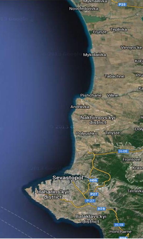
1850’s and 2014 maps of the Sevastopol area and coast of the Crimean peninsula. The current day version from GoogleMaps (March 2nd 2014).

The locations of wells (black dots labeled as “brunner”, wells) are carefully labeled on the map. This detail also made me think that this might be a military map. The book belonged to a gentleman’s family so perhaps the owner of the map was a finnish officer charged with logistics and arranging food/water for the russian troops. At the time Finland was an autonomous grand duchy of the Russian Empire and was not allowed an army of her own.
The officer probably returned to his family in Finland. Maybe he kept the map as a war souvenir and placed it between the pages of the geography book. After all maps were not as easy to come by as they are today.
